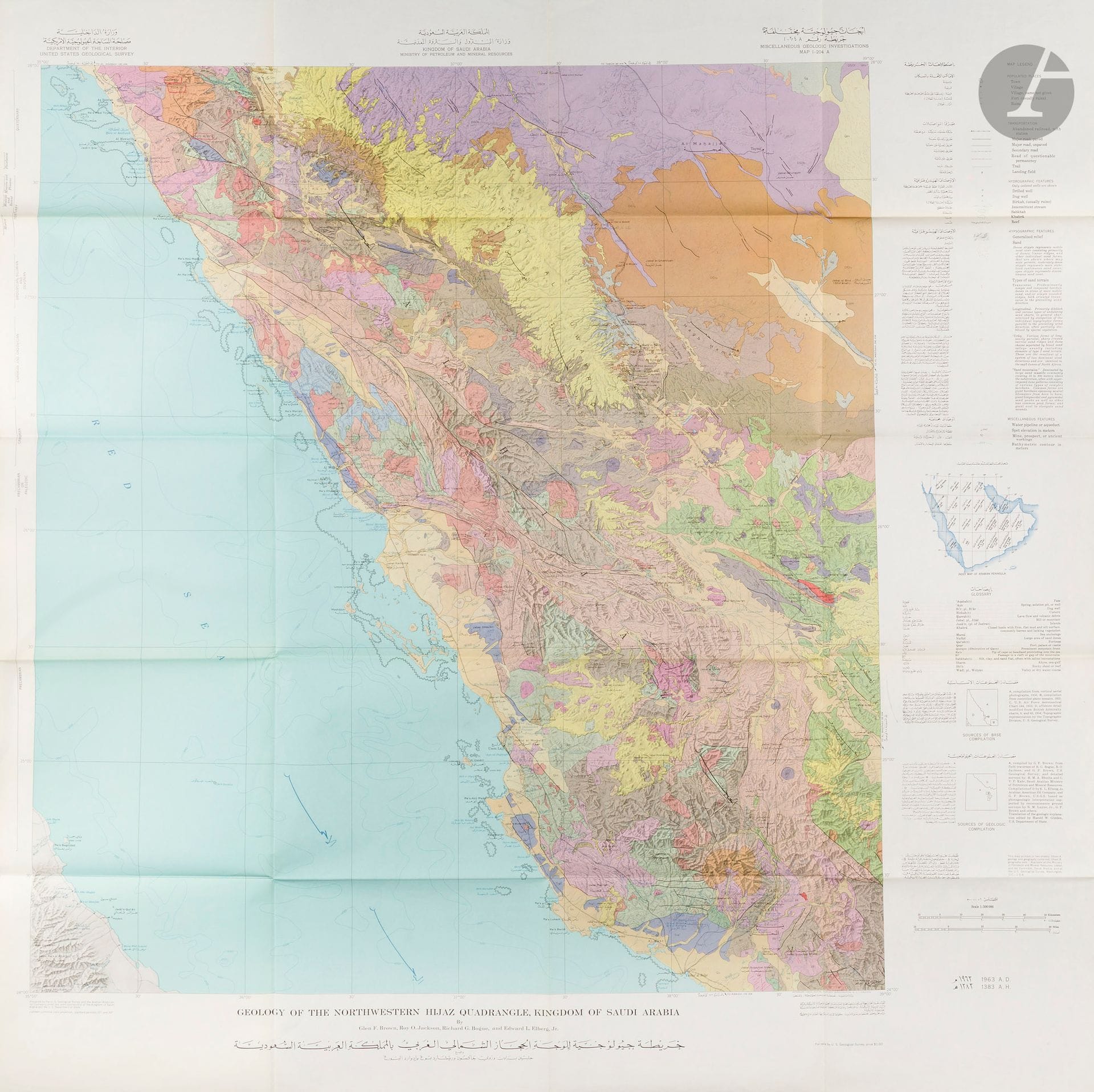
United States Geological Survey of the Kingdom of Saudi Arabia. Geological maps of the Kingdom of Saudi Arabia (13 maps). Washington, D.C., U.S. Geological Survey, 1958-1963. Thirteen color-printed maps folded in their presentation envelopes. In excellent condition. Approximate dimensions of one map: 103 × 101 cm. A set of 13 maps from a series of twenty-one bilingual, dual-dated maps published as part of a collaboration between the government of Saudi Arabia and the U.S. Geological Survey. This project was the first to produce a complete series of geological and geographical maps of the Kingdom of Saudi Arabia and played a decisive role in its emergence as a major world power in the production of natural resources. The project supervisor was an experienced geologist, Glen F. Brown, who had first traveled to the Kingdom in the mid-1940s and had established excellent relations with Saudi officials. They asked him to renew his cooperation in 1950, which led to the formation of a team composed of Brown, geologists appointed by the Saudi Ministry of Finance and National Economy, and geologists from Saudi Aramco. Among the most prominent Aramco geologists were R. A. Bramkamp and L. F. Ramirez. Together with Glen F. Brown, who oversaw the collaboration, Bramkamp in February 1955 planned the entire program, defining everything from the map scales, areas of responsibility, and types of relief representation to the bilingual toponyms. As Aramco’s chief geologist, Bramkamp was responsible for compiling the sedimentary areas of Arabia. This responsibility was taken over by Ramirez following Bramkamp’s premature death in September 1958. The topographers divided the Peninsula into 21 quadrangular sections (numbered I-200 through I-220), each covering an area of 3 degrees of longitude by 4 degrees of latitude. All maps were produced at a scale of 1:500,000 and issued in two series: a combined map of geography and geology (marked with the annex “A”) and a geography-only map (“B”). The first geographic quadrangle was published in July 1956 and the last in September 1962. The first sheet of the geologic series was published in July 1956 and the final one in early 1964. Although ultimately motivated by the search for oil, gas, and minerals, the exploration of the Kingdom’s resources was initially driven by the vital need for water. In 1944, King ʿAbd al-ʿAzīz called upon the United States to send an expert capable of identifying and mapping natural resources, in particular groundwater reserves. Ten years later, in 1954, the Saudi Ministry of Finance, the USGS, and Aramco launched the first complete series of geographical and geological maps of the country, published in both Arabic and English. Personally supported by Ibn Saud, this project served not only resource exploration but also the development of agriculture, civil and military infrastructure. Its groundbreaking results remain the foundation of all modern cartography of the Kingdom.
Estimate
€1,500 - €2,000
Result
€2,148
Buyer's premium
30%
United States Geological Survey of the Kingdom of Saudi Arabia. Geological maps of the Kingdom of Saudi Arabia (13 maps). Washington, D.C., U.S. Geological Survey, 1958-1963. Thirteen color-printed maps folded in their presentation envelopes. In excellent condition. Approximate dimensions of one map: 103 × 101 cm. A set of 13 maps from a series of twenty-one bilingual, dual-dated maps published as part of a collaboration between the government of Saudi Arabia and the U.S. Geological Survey.
This project was the first to produce a complete series of geological and geographical maps of the Kingdom of Saudi Arabia and played a decisive role in its emergence as a major world power in the production of natural resources.
The project supervisor was an experienced geologist, Glen F. Brown, who had first traveled to the Kingdom in the mid-1940s and had established excellent relations with Saudi officials. They asked him to renew his cooperation in 1950, which led to the formation of a team composed of Brown, geologists appointed by the Saudi Ministry of Finance and National Economy, and geologists from Saudi Aramco.
Among the most prominent Aramco geologists were R. A. Bramkamp and L. F. Ramirez. Together with Glen F. Brown, who oversaw the collaboration, Bramkamp in February 1955 planned the entire program, defining everything from the map scales, areas of responsibility, and types of relief representation to the bilingual toponyms. As Aramco’s chief geologist, Bramkamp was responsible for compiling the sedimentary areas of Arabia. This responsibility was taken over by Ramirez following Bramkamp’s premature death in September 1958.
The topographers divided the Peninsula into 21 quadrangular sections (numbered I-200 through I-220), each covering an area of 3 degrees of longitude by 4 degrees of latitude. All maps were produced at a scale of 1:500,000 and issued in two series: a combined map of geography and geology (marked with the annex “A”) and a geography-only map (“B”). The first geographic quadrangle was published in July 1956 and the last in September 1962. The first sheet of the geologic series was published in July 1956 and the final one in early 1964.
Although ultimately motivated by the search for oil, gas, and minerals, the exploration of the Kingdom’s resources was initially driven by the vital need for water. In 1944, King ʿAbd al-ʿAzīz called upon the United States to send an expert capable of identifying and mapping natural resources, in particular groundwater reserves. Ten years later, in 1954, the Saudi Ministry of Finance, the USGS, and Aramco launched the first complete series of geographical and geological maps of the country, published in both Arabic and English. Personally supported by Ibn Saud, this project served not only resource exploration but also the development of agriculture, civil and military infrastructure. Its groundbreaking results remain the foundation of all modern cartography of the Kingdom.
Sale
Tuesday 16 December 2025・14:30 (Europe/Paris)
Sale location coming soon
3, rue Favart
75002 Paris