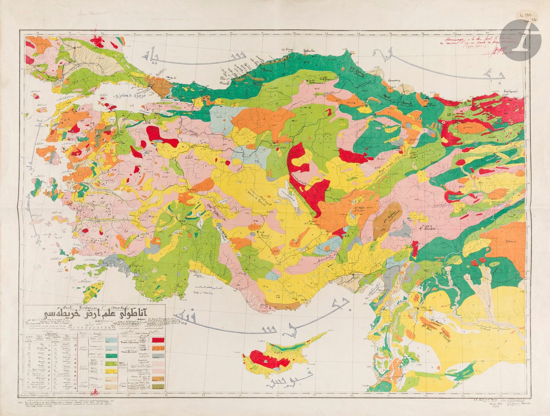
KENAN, Damat / SAYAR, Ahmed Malik. Carte géologique d'Anatolie. Stamboul, Imprimerie impériale, 1920. 620 x 860 mm. Lithographié en couleurs. Color lithographed folding map, 73 × 90 cm overall. With a handwritten dedication by G. Nègre to the Geological Society of France, and numerous manuscript annotations and French translations. Geological map of Asia Minor, by Damat Kenan and Ahmet Malik Sayar. Issued and printed in 1336 Rumi Calendar. Text is Ottoman Turkish script. Includes legend, identifying geological zones, and location of mines with a color-coded key to mineral deposits. The map shows roads and railroads. This important map also bears a handwritten dedication by Georges Nègre to the Geological Society of France: ‘Tribute to the Geological Society of France in memory of a year spent in Kemalist country (1920–1921).’ Signed G. Nègre and dated June 1922. With handwritten French translations of the Ottoman text and cartographic annotations. Created during the final years of the Ottoman Empire, the map reflects the transition to the Turkish Republic. It was produced with the intention of supporting the new nation by highlighting its natural resources. The map served as a fundamental tool for scientific exploration and resource management, in line with the modernization efforts led by Mustafa Kemal Atatürk.
Estimate
€200 - €300
Result
€631
Buyer's premium
30%
KENAN, Damat / SAYAR, Ahmed Malik. Carte géologique d'Anatolie. Stamboul, Imprimerie impériale, 1920. 620 x 860 mm. Lithographié en couleurs. Color lithographed folding map, 73 × 90 cm overall. With a handwritten dedication by G. Nègre to the Geological Society of France, and numerous manuscript annotations and French translations. Geological map of Asia Minor, by Damat Kenan and Ahmet Malik Sayar. Issued and printed in 1336 Rumi Calendar. Text is Ottoman Turkish script. Includes legend, identifying geological zones, and location of mines with a color-coded key to mineral deposits. The map shows roads and railroads.
This important map also bears a handwritten dedication by Georges Nègre to the Geological Society of France: ‘Tribute to the Geological Society of France in memory of a year spent in Kemalist country (1920–1921).’ Signed G. Nègre and dated June 1922. With handwritten French translations of the Ottoman text and cartographic annotations.
Created during the final years of the Ottoman Empire, the map reflects the transition to the Turkish Republic. It was produced with the intention of supporting the new nation by highlighting its natural resources. The map served as a fundamental tool for scientific exploration and resource management, in line with the modernization efforts led by Mustafa Kemal Atatürk.
Sale
Tuesday 16 December 2025・14:30 (Europe/Paris)
Sale location coming soon
3, rue Favart
75002 Paris