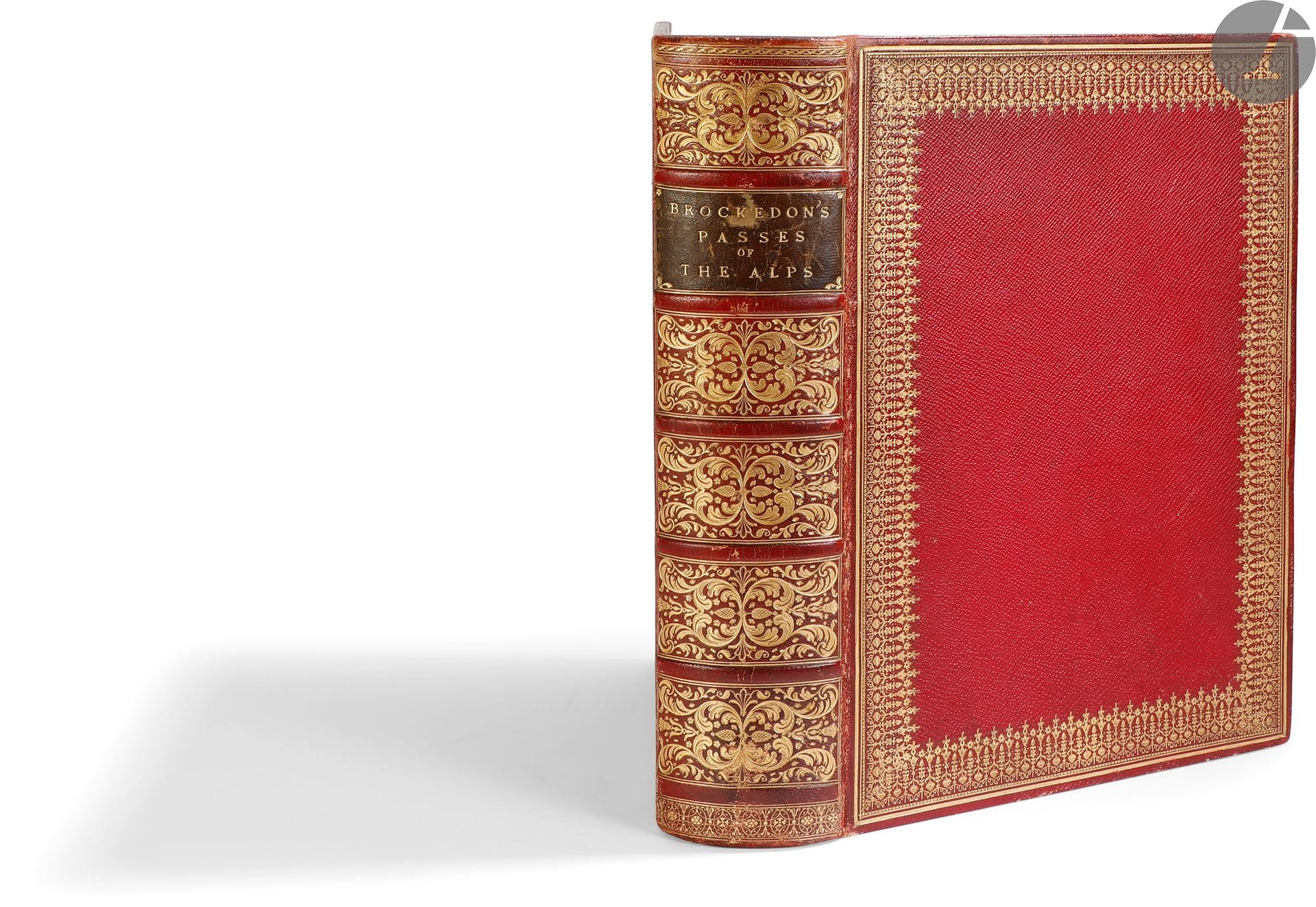
*BROCKEDON (William). Illustrations of the passes of the Alps, by which Italy communicates with France, Switzerland, and Germany. London: for the author, Rodwell, J. and A. Arch, Colnaghi and son, F.G. Moon, Simpkin and Marshall, Walther, 1828-1829. - 2 volumes in one large in-4 volume, 290 x 210: I. (3 ff.), 14 pp., 8 plates, 1 map; 16 pp., 8 plates, 1 map; 16 pp., 8 plates, 1 map; 16 pp., 8 plates, 1 map; 14 pp., 8 plates, 1 map; II. (2 ff.), 16 pp. 8 plates, 1 map; 12 pp. 8 plates, 1 map; 16 pp. 8 plates, 1 map; 16 pp. 8 plates, 1 map; 16 pp. 8 plates, 1 map; 28 pp. 8 plates, 2 maps. Red chagrin, large gilt roulette on the boards, richly decorated spine, triple gilt fillet inside, gilt edges (period binding). First edition of this important work on the Alps by the painter, writer and inventor William Brockedon (1787-1854). He describes 12 passes that he traveled in 1824 and 1825 in search of Hannibal's route. The work is divided into 12 parts, each one including from 12 to 28 pages of text and 8 engravings and 1 map, except for the last one which includes 2 maps. There are 96 plates engraved on steel from the author's drawings and 13 maps, one of which is a fold-out map of the Alps. The 12 passes described and represented are the following ones: Petit-Saint-Bernard - Mont Genèvre - Mont-Cenis - Saint-Gothard - Grand Saint-Bernard - Stelvio - Corniche - Grimsel and Gries - Bernardin and Splugen - Brenner - Tende Pass and Argentière - Simplon. English binding of the time. Copy largely unbound, the inner hinge of the first plate being entirely split. Rubbing from use. Some foxing. Handwritten ex-dono in English on the verso of the first endpaper, dated March 6, 1838.
Estimate
€300 - €400
Result
€750
Buyer's premium
25%
*BROCKEDON (William).
Illustrations of the passes of the Alps, by which Italy communicates with France, Switzerland, and Germany.
London: for the author, Rodwell, J. and A. Arch, Colnaghi and son, F.G. Moon, Simpkin and Marshall, Walther, 1828-1829. - 2 volumes in one large in-4 volume, 290 x 210: I. (3 ff.), 14 pp., 8 plates, 1 map; 16 pp., 8 plates, 1 map; 16 pp., 8 plates, 1 map; 16 pp., 8 plates, 1 map; 14 pp., 8 plates, 1 map; II. (2 ff.), 16 pp. 8 plates, 1 map; 12 pp. 8 plates, 1 map; 16 pp. 8 plates, 1 map; 16 pp. 8 plates, 1 map; 16 pp. 8 plates, 1 map; 28 pp. 8 plates, 2 maps. Red chagrin, large gilt roulette on the boards, richly decorated spine, triple gilt fillet inside, gilt edges (period binding).
First edition of this important work on the Alps by the painter, writer and inventor William Brockedon (1787-1854). He describes 12 passes that he traveled in 1824 and 1825 in search of Hannibal's route.
The work is divided into 12 parts, each one including from 12 to 28 pages of text and 8 engravings and 1 map, except for the last one which includes 2 maps. There are 96 plates engraved on steel from the author's drawings and 13 maps, one of which is a fold-out map of the Alps.
The 12 passes described and represented are the following ones: Petit-Saint-Bernard - Mont Genèvre - Mont-Cenis - Saint-Gothard - Grand Saint-Bernard - Stelvio - Corniche - Grimsel and Gries - Bernardin and Splugen - Brenner - Tende Pass and Argentière - Simplon.
English binding of the time.
Copy largely unbound, the inner hinge of the first plate being entirely split. Rubbing from use. Some foxing. Handwritten ex-dono in English on the verso of the first endpaper, dated March 6, 1838.
Sale
Thursday 14 April 2022・14:00 (Europe/Paris)
Sale location coming soon
3, rue Favart
75002 Paris