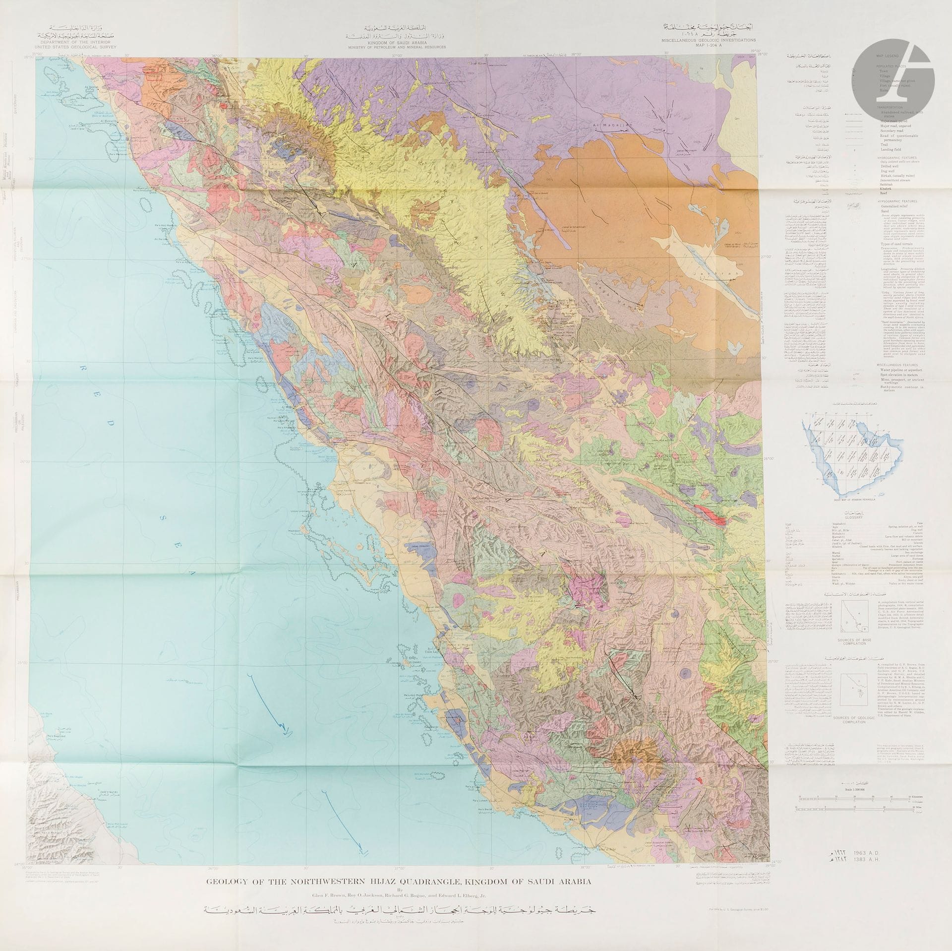
United States Geological Survey of the Kingdom of Saudi Arabia. Geological maps of the Kingdom of Saudi Arabia (13 maps). Washington, D.C., U.S. Geological Survey, 1958-1963. 13 cartes imprimées en couleurs repliées dans leurs enveloppes de présentation. Parfait état. Dimensions à titre indicatif d’une carte : 103 x 101 cm. Ensemble de 13 cartes d’une série de vingt et une cartes bilingues et à double datation publiées dans le cadre d’une collaboration entre le gouvernement de l’Arabie saoudite et l’U.S. Geological Survey. Ce projet fut le premier à produire une série complète de cartes géologiques et géographiques du Royaume d’Arabie saoudite et joua un rôle déterminant dans son émergence en tant que puissance mondiale majeure dans la production de ressources naturelles. Le superviseur du projet était un géologue chevronné, Glen F. Brown, qui s’était déjà rendu dans le Royaume au milieu des années 1940 et y avait noué d’excellentes relations avec les responsables saoudiens. Les topographes divisèrent la péninsule en 21 sections quadrangulaires numérotées de I-200 à I-220, chacune couvrant une zone de 3 degrés de longitude sur 4 degrés de latitude. Toutes les cartes furent produites à l’échelle 1 : 500 000 et publiées en deux séries : une carte combinant géographie et géologie (marquée de l’annexe « A ») et une carte de géographie seule (« B »). La première carte géographique de quadrilatère fut publiée en juillet 1956 et la dernière en septembre 1962 […] La première feuille de la série géologique fut publiée en juillet 1956 et la dernière au début de 1964. Liste des cartes : - Geologic map of the central Persian Gulf quadrangle Kingdom of Saudi Arabia By Richard A. Bramkamp and Leon F. Ramirez - Geologic map of the southern Hijaz quadrangle, Kingdom of Saudi Arabia By Glen F. Brown, Roy O. Jackson, R.G. Bogue, and W.H. MacLean - Geologic map of the nortwestern Hijaz quadrangle, Kingdom of Saudi Arabia By Glen F. Brown, Roy O. Jackson, R.G. Bogue, and Edward L. Elberg Jr. - Geologic map of the Wadin Al Batin quadrangle Kingdom of Saudi Arabia By Richard A. Bramkamp and Leon F. Ramirez - Geologic map of the Asir quadrangle Kingdom of Saudi Arabia By Glen F. Brown and Roy O. Jackson - Geologic map of the northern Tuwayq quadrangle Kingdom of Saudi Arabia By Richard A. Bramkamp and Leon F. Ramirez - Geologic map of the Tihamat Ash Sham quadrangle Kingdom of Saudi Arabia By Glen F. Brown and Roy O. Jackson - Geologic map of the Wadi Ar Rimah quadrangle Kingdom of Saudi Arabia By Richard A. Bramkamp, Leon F. Ramirez, Glen F. Brown, and Arthur E. Pocock - Geologic map of the Darb Zubaydah quadrangle Kingdom of Saudi Arabia By Richard A. Bramkamp and Leon F. Ramirez - Geologic map of the Jaw-Sakakah quadrangle Kingdom of Saudi Arabia By Richard A. Bramkamp, Leon F. Ramirez, Max Steineke, and William H. Reiss - Geologic map of the Wadi As Sihran quadrangle Kingdom of Saudi Arabia By Richard A. Bramkamp, Glen F. Brown, Donald A. Holm and Newton M. Layne Jr. - Geologic map of the western Rub Al Khali quadrangle Kingdom of Saudi Arabia By Richard A. Bramkamp, Ruel D. Gierhart, Lloyd D. Owens and Leon F. Ramirez - Geologic map of the southern Nadj quadrangle Kingdom of Saudi Arabia By Roy O. Jackson, Richard G. Bogue, Glen F. Brown and Ruel D. Gierhart. - James V. Parry, « Mapping Arabia », in : Saudi Aramco World 2004/1
Estimation
1 500 € - 2 000 €
Résultat
2 148 €
Frais de vente
30%
United States Geological Survey of the Kingdom of Saudi Arabia. Geological maps of the Kingdom of Saudi Arabia (13 maps). Washington, D.C., U.S. Geological Survey, 1958-1963. 13 cartes imprimées en couleurs repliées dans leurs enveloppes de présentation. Parfait état. Dimensions à titre indicatif d’une carte : 103 x 101 cm.
Ensemble de 13 cartes d’une série de vingt et une cartes bilingues et à double datation publiées dans le cadre d’une collaboration entre le gouvernement de l’Arabie saoudite et l’U.S. Geological Survey.
Ce projet fut le premier à produire une série complète de cartes géologiques et géographiques du Royaume d’Arabie saoudite et joua un rôle déterminant dans son émergence en tant que puissance mondiale majeure dans la production de ressources naturelles.
Le superviseur du projet était un géologue chevronné, Glen F. Brown, qui s’était déjà rendu dans le Royaume au milieu des années 1940 et y avait noué d’excellentes relations avec les responsables saoudiens.
Les topographes divisèrent la péninsule en 21 sections quadrangulaires numérotées de I-200 à I-220, chacune couvrant une zone de 3 degrés de longitude sur 4 degrés de latitude. Toutes les cartes furent produites à l’échelle 1 : 500 000 et publiées en deux séries : une carte combinant géographie et géologie (marquée de l’annexe « A ») et une carte de géographie seule (« B »). La première carte géographique de quadrilatère fut publiée en juillet 1956 et la dernière en septembre 1962 […] La première feuille de la série géologique fut publiée en juillet 1956 et la dernière au début de 1964.
Liste des cartes :
- Geologic map of the central Persian Gulf quadrangle Kingdom of Saudi Arabia By Richard A. Bramkamp and Leon F. Ramirez
- Geologic map of the southern Hijaz quadrangle, Kingdom of Saudi Arabia By Glen F. Brown, Roy O. Jackson, R.G. Bogue, and W.H. MacLean
- Geologic map of the nortwestern Hijaz quadrangle, Kingdom of Saudi Arabia By Glen F. Brown, Roy O. Jackson, R.G. Bogue, and Edward L. Elberg Jr.
- Geologic map of the Wadin Al Batin quadrangle Kingdom of Saudi Arabia By Richard A. Bramkamp and Leon F. Ramirez
- Geologic map of the Asir quadrangle Kingdom of Saudi Arabia By Glen F. Brown and Roy O. Jackson
- Geologic map of the northern Tuwayq quadrangle Kingdom of Saudi Arabia By Richard A. Bramkamp and Leon F. Ramirez
- Geologic map of the Tihamat Ash Sham quadrangle Kingdom of Saudi Arabia By Glen F. Brown and Roy O. Jackson
- Geologic map of the Wadi Ar Rimah quadrangle Kingdom of Saudi Arabia By Richard A. Bramkamp, Leon F. Ramirez, Glen F. Brown, and Arthur E. Pocock
- Geologic map of the Darb Zubaydah quadrangle Kingdom of Saudi Arabia By Richard A. Bramkamp and Leon F. Ramirez
- Geologic map of the Jaw-Sakakah quadrangle Kingdom of Saudi Arabia By Richard A. Bramkamp, Leon F. Ramirez, Max Steineke, and William H. Reiss
- Geologic map of the Wadi As Sihran quadrangle Kingdom of Saudi Arabia By Richard A. Bramkamp, Glen F. Brown, Donald A. Holm and Newton M. Layne Jr.
- Geologic map of the western Rub Al Khali quadrangle Kingdom of Saudi Arabia By Richard A. Bramkamp, Ruel D. Gierhart, Lloyd D. Owens and Leon F. Ramirez
- Geologic map of the southern Nadj quadrangle Kingdom of Saudi Arabia By Roy O. Jackson, Richard G. Bogue, Glen F. Brown and Ruel D. Gierhart.
- James V. Parry, « Mapping Arabia », in : Saudi Aramco World 2004/1
Vente
mardi 16 décembre 2025・14:30 (Europe/Paris)
Lieu de vente à venir
3, rue Favart
75002 Paris